Beaches
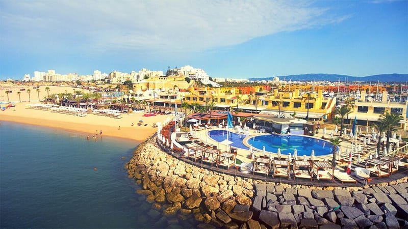
NoSoloAgua Beach
Dedicated to leisure and entertainment, NoSoloÁgua Portimão Praia features decoration inspired by the East, with wooden beds and sofas that invite you to relax, Buddhas and Ganeshas from Bali that transport you on a journey of emotions. Relaxing is the watchword, or dancing with your feet in the sand while enjoying a signature cocktail. NoSoloÁgua Portimão – Praia, stands out for its privacy and fun, even on a beach open to the public. 1 Restaurant and Bar, where the concept of beach space is reinvented. Google Maps.: 37.115267, -8.527345
Learn More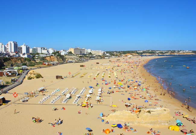
Stone beach
Praia da Rocha is a beach in the municipality of Portimão, in the Algarve. This beach has a large stretch of sand, in a total area of around 146,000 m², along 1.5 km of coastline. Next to the beach stands the Fortress of Santa Catarina, built in the 17th century to defend the mouth of the Arade River. Google Maps.: 37.118750, -8.536361
Learn More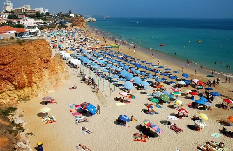
Praia do Vau
Praia do Vau is an ocean beach in the municipality of Portimão, in the Algarve, Portugal. It has a beach flanked by gentle cliffs. It is a peaceful beach, known for its iodine and the clay of the cliffs, and also for the irregular rock formations. Google Maps.: 37.120378, -8.558548
Learn More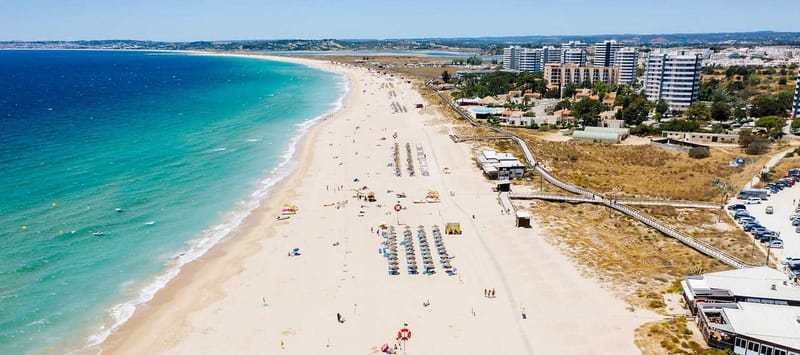
Alvor beach
Praia de Alvor is one of the ex-libris of the Portimão region. In addition to the Blue Flag, it was also distinguished with the Quality of Gold, awards that confirm both the environmental quality of the waters and the infrastructures. The vast sandy beach is another of the charms of this beach located at the east of the Ria de Alvor. The sandy barriers of Alvor make possible the existence of an interior lagoon with salt marsh banks and calm water channels, making this habitat a sanctuary for countless species of aquatic birds, resident or passing through, and for many species of fish and molluscs. . Alvor's dune system was refurbished and there is now a network of walkways and paths that contribute to the preservation of the dune system and provide access to the beaches and jetty. A nature route, which is an accessible route, offers points of stay and viewpoints, allowing contact with the typical habitats of the Ria de Alvor: the dunes, the marshes and the estuary.
Learn More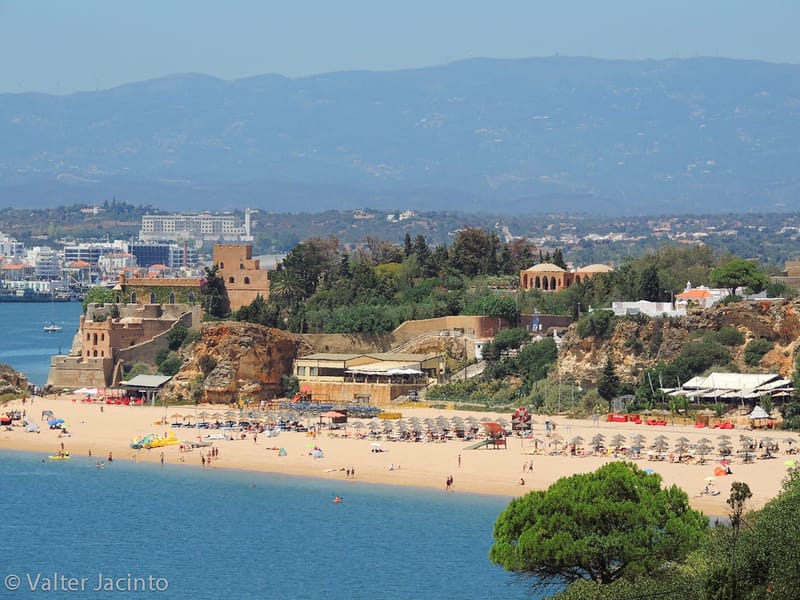
Praia Grande --- Ferragudo
Praia Grande is located in the parish of Ferragudo, in the municipality of Lagoa, in the Algarve, Portugal. This beach is located on the estuary of the river Arade at the entrance to the port of Portimão, east of the Castelo de São João de Arade. Google Maps.: 37.118231, -8.520859
Learn More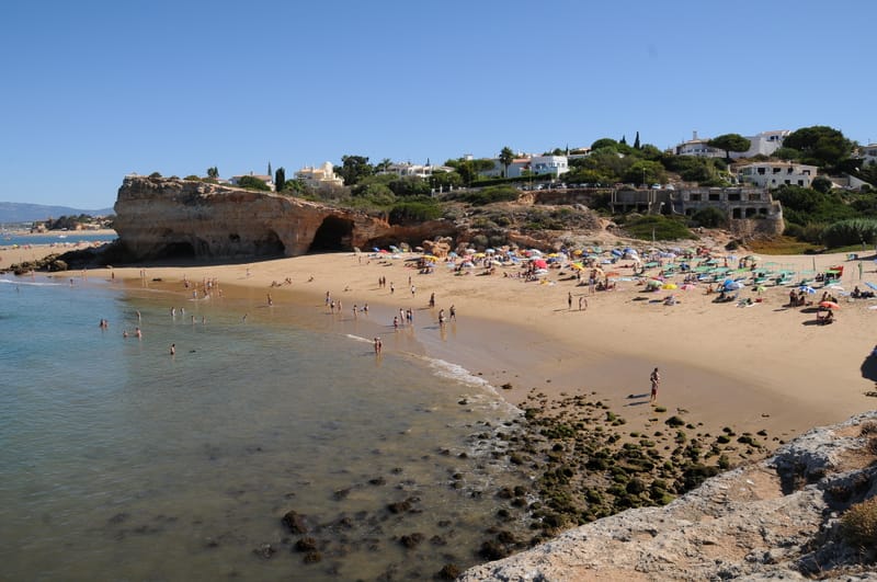
Pintadinho Beach --- Ferragudo
This is the first maritime beach in the municipality of Lagoa, after the mouth of the Arade; the beach extends to the north of Ponta do Altar, a narrow and elongated point where a lighthouse was built. The rich scrubland of the Algarve Barrocal reaches the coastline here, blending with the typical vegetation of the cliffs exposed to sea winds. The beach is thus framed by a dense patch of vegetation: mastic, thyme, myrtle, dwarf palm, broom, sargasso and rosella grow wrapped in a tangle of lianas. On the cliffs of warm colors, various marine fossils are visible, as well as remarkable models resulting from marine erosion on the limestone rock, as is the case of the visible caves at the base of Ponta do Altar. On the cliff that delimits the northern end of the beach, there is a huge dome with two arches. Facing west, you can see from the Pintadinho beach the mouth of the River Arade, formalized by jetties, and in the background the marina and the city of Portimão. Note: Given the possibility of landslides and falling rocks, it is recommended that you maintain a safe distance from the cliffs. Google Maps.: 37.107935, -8.517452
Learn More
Praia dos Caneiros --- Ferragudo
Praia dos Caneiros is a Portuguese beach located in the parish of Ferragudo, municipality of Lagoa, with the peculiar characteristic of having in front a large rock isolated by the water which is called "Leixão das Gaivotas" because large numbers of said seabird. Note: Given the possibility of landslides and falling rocks, it is recommended that you maintain a safe distance from the cliffs. Google Maps.: 37.105655, -8.513178
Learn More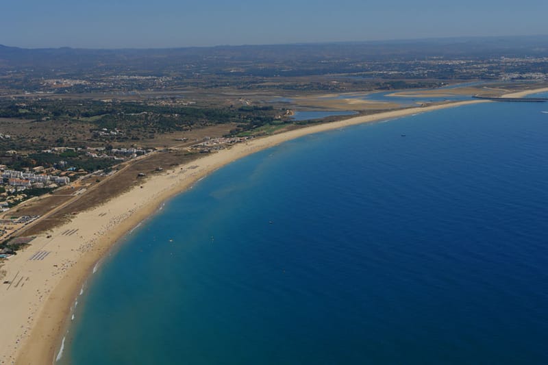
Meia Praia --- Lagos
Meia Praia is a beach located in Lagos, in the Algarve, Portugal. It has the Blue Flag and has all the support and beach services. It has a large beach. At its eastern end there is the Forte da Meia Praia, which defended the bay of Lagos in the 17th and 18th centuries. This is the largest beach in Lagos, with an extension of more than four kilometers of fine white sand. Spacious beach with golden sand, nestled between cliffs, with hotels, cafes and bars nearby. Google Maps.: 37.118322, -8.646198
Learn More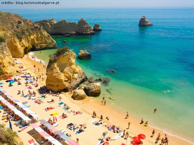
Praia Dona Ana --- Lagos
The sand of Praia D. Ana unfolds in recesses generated by the cut of the cliff, providing sheltered corners for bathers. Once in the water, a walk with a mask and fins reveals a different color: algae, anemones, starfish, urchins, shrimps or schools of small fish, populate the immersed rocky blocks. Dona Ana is a famous and very popular beach, having already been considered one of the best beaches in the world by specialist publications. Note: Given the possibility of landslides and falling rocks, it is recommended that you maintain a safe distance from the cliffs, as well as being careful when walking on top of them. Google Maps.: 37.091502, -8.669728
Learn More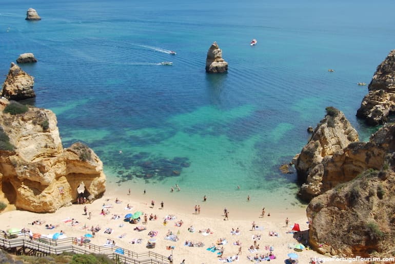
Praia do Camilo --- Lagos
Nestled between jagged cliffs, Praia do Camilo has a small sand which is accessed by a staircase with about 200 steps. Before starting the descent, enjoy the breathtaking landscape. Very close and with access from the same road, is Ponta da Piedade, an impressive rock formation, with jagged shapes and caves excavated by the sea. This is one of the ex-libris of the region, which can be admired in its fullness on a boat trip, going through the interior of the caves and the small deserted beaches nestled between the rocks. Google Maps.: 37.086684, -8.668951
Learn More